Wednesday, June 30, 2010

Eklutna Lakeside Trail

There is very little evidence of the recent Eklutna Lake fire at the parking lot. Toward the end of the lake a pretty strong burnt forest smell was pervasive. The massive avalanche a while back left a ton of dead trees at the end of the lake, and those burned. There were spotty burnt patches on the mountain and a surprising mix of dead and alive trees in the same area.

Burnt Trees on Eklutna Lakeside Trail


Looking up Toward the Eklutna Glacier

 
Posted by Picasa

T.3:D.23:EG.950

Monday, June 28, 2010

Hatcher to Kashwitna River: Day 3

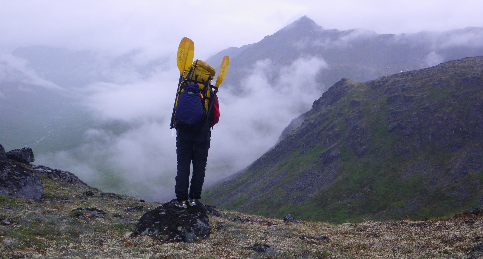
I was so relieved to wake up to no rain and no immediate bush-whacking. Pack-rafting is super amusing to me and I was excited to get into the river. The upper Kashwitna was super mellow flowing between 4-6 mph without paddling for about the first 4 miles.

Super Mellow Boating


Then a 1 mile section of very engaging water due to a feisty gradient started. The water wasn't huge and super pushy, I was able to spot a lot of holes and rocks before I was right on top of them. But it was swift and amusement park ride like for sure!!

A Little Rapid Section


Originally we were going to take out 10 miles down the Kashwitna river and head up and over another pass to Sheep creek and float that to the car. However when we needed to make this crucial decision the mountains were coated with that thick whipped layer of clouds, the exact stuff we had spent the previous 2 days hiking in. Neither of us could rationalize how it was a good idea, and then we talked about how Sheep creek was going to be way harder than what we had just paddled and maybe we should wait to do it with more people. The pluses for bailing started to add up real quick and we made a decision to float the Kashwitna to the road.
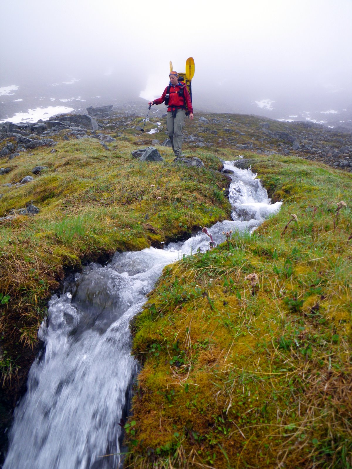
Greenery


The river got painfully slow for what felt like hours, there were ox bows like I've never seen before. I found that I like paddling closer to shore because I could really tell that I was moving. Floating with no paddling averaged 1.8-3 mph but paddling brought it up to 4-5 mph, according to the GPS.

We spotted some people on the riverbank and pulled over to say hi. Turns out we ran into probably one of the few people that have access to the river and four wheeler trails. He told us no fewer than 50 times about how his Grandpa had bought the land and he was basically the ruler in the area. He also told us that we were stupid for floating the Kashwitna and that if we didn't take out within the next mile we would come to a section that no one had ever been down and anyone who was stupid enough to try it would die. Even though this guy was completely drunk, rude and obnoxious, he still had credibility in being the owner of the lands grandson and there was a gate that only he could open. He told us it was his moral duty to give us a ride out of there. Kellie and I had a quick chat and decided that this weird twist of fate was too peculiar to ignore.

The Four Wheeler Gang

 
Posted by Picasa

That four wheeler ride was hands down the most dangerous part of my trip. I felt straight out of a public warning commercial, and a traumatic brain injury waiting to happen. But I made it back to my car, drove about 5 miles overheated and ended the trip being towed back to Anchorage, I'm thankful I have AAA.


I'd do this trip again, but not in the same weather conditions. A fall trip when the foliage is reduced could also be good. Or just getting a drop off at the lake above sheep creek and doing it as a day trip is also appealing...

In retrospect I wish I had researched taking the Kashwitna river out to the road before the trip, all we knew about it at the time was that Roman had made side comment about no one actually finishing his route and that they bailed down the Kashwitna. But we knew nothing concrete except what the contour lines and this guy on the river bank told us. Turns out we probably missed a super fun float, but I made decisions based on the information and situation at that time, and with what I knew, I have no regrets. Live and learn, there are always more opportunities.

Sunday, June 27, 2010

Hatcher to Kashwitna River: Day 2

Kellie and I woke up to a much improved weather situation. Although it was still cloudy bordering on dreary, we could finally see the mountains, and where we wanted to go.

Looking Down Towards Peter's River


The walking continued to be good through alpine tundra and boulder fields.

Alpine Lakes with Ice


Heading to Stegosaurus Pass


We thought it was pretty much downhill and easy travel to the Kashwitna river, and it probably would have been but we ended up back in the clouds reading contour lines. Its hard when there is only you and your partner because if you don't agree on the route, then there is no tie breaker.

The Nice Bushes

 
Posted by Picasa

Instead of staying high, we went low and ended up bing bonging from the river back up and down the mountain, then we started to run into cliffs. I was not happy to take off my pack and crawl up a ledge over a steep death drop, but it seemed like the best decision at the time. After infuriatingly slow travel we finally popped out on the banks of the Kashwitna river and set up camp.

Saturday, June 26, 2010

Hatcher Pass to Kashwitna River: Day 1

Kellie and I have this uncanny ability to not only buy the exact same clothing items, but wear them at the same exact time. It always starts my trips out with Kellie smiling, we're super cute and disgusting, awesome dichotomy. We got our idea for this trip from Roman Dial's blog post at http://packrafting.blogspot.com/2010/05/wilderness-classic-independent-sheep.html It looked like an ideal adventure for Kellie and I.


We may have been initially distracted by our cute matching outfits, but after four miles of hiking on the Craige Creek road/trail we were up in the clouds and forced to pay a lot of attention on where we were trying to go. It is very difficult to navigate in rocky mountains when you can only see 100 yards in front of yourself. We literally were following the contour lines on the GPS map, although mountains are never as straight!

Kellie Doing the Careful Step Down


We went up and over a couple of passes at the 4000-5000 foot level, all of it in the clouds. For me its very painful to travel in beautiful mountain country and not see the mountains, the whole time I'm out I think about having to come back. It was very typical of other things I've hiked in Hatcher pass, huge granite boulder fields peppered with tundra and alpine lakes.


We had left the car at 3:30ish and by 10 pm were over the wet oppressive mist and slippery ass rocks. There were so many amazing places to camp next to streams on soft flat tundra, we finally chose one and went to sleep with dreams of clearer days.

 
Posted by Picasa

Short Slide Show

Monday, June 21, 2010

Late Night Mint Hut Trot

I work nights now, and I was on for 3 then off 1, back on for 3, so on my one night off I didn't really want to switch back to a day schedule. The only way I felt I could ensure I wouldn't fall asleep was to go do something outside. I stopped by the folks house, celebrated Father's day and then headed up to Hatcher Pass. I was a bit torn about where to go, but settled on the Gold Mint trail. I left the car at midnight, my camera made it look darker than it was, overall not very good lighting for my point and shoot camera.

Almost the Solstice


I can't really call my pace a walk, jog, or run, but more of a trot. The first 5 miles of the trail have been updated and is in excellent condition...the last 3 miles could use a little work. Although the night was clear I got completely soaked from the dew on the bushes.

Me in the Gold Mint Valley


The only wildlife I saw all night were some very busy beavers. It was very quiet and peaceful out there.

 
Posted by Picasa


T.4:45:D.16.3:EG.2700

Wednesday, June 16, 2010

Happy Birthday to Me

The South fork of Eagle River valley was beckoning me as I considered my options on another dreary summer day. When its crappy out I'm glad I can get my outdoor fix in a couple hours with a good run.

Its so funny that as a teenager I always wanted to look older, now as nearly a middle aged adult, I of course want the opposite. More than looks though is the decline of body parts and length of recovery after doing something hard. Getting old sucks, I don't see myself handling my 60's gracefully.


It was nice to go for a run in a beautiful place and be thankful for the life I have. I wish I didn't always want to be faster and stronger, why can't I ever recognize when I'm actually fit? In retrospect to where I am now, every summer before this one I've been fit and skinny. The lesson: I can always get fatter and slower than I am now, and should be more happy with less.

 
Posted by Picasa

I always feel a bit recalcitrant about celebrating my birthday because its the same day that my brother died fifteen years ago. We were close and its hard to celebrate and mourn at the same time.

Monday, June 14, 2010

Flat Top

With Hurricane force winds in the Chugach, George Anne and I decided it wouldn't be prudent to try our original objective, instead we opted for a quick hike up Flat top, followed by a big bowl of Pho.

 
Posted by Picasa

George Anne mentioned it would be a great day to go the rock gym, but for some reason I just can't make myself do it. I want the upper body work out, but gym climbing just remains uber unappealing. So far I'm failing to reach my goal of doing any climbing during the summer....

Friday, June 11, 2010

McHugh Phew

The Rabbit creek valley is the biggest natural wind tunnel I've ever been in. Its consistently the windiest place in Anchorage, or at least it sure seems like it! It really sucked the air out of my lungs and gave me a much better workout with all the wind resistance.


South Side of Ptarmigan Peak

 
Posted by Picasa


The exercise and food induced coma sure has been making take a nap in the afternoon before night shift much easier...

T:1:20.D:3.57.EG:2264

Thursday, June 10, 2010

Urban Boating on Campbell Creek

I ride over Campbell creek about 6 times a week on my way to and from work and had noticed that it had gained a little bit of volume. Rapheal has told me about good times on Campbell creek for years, but I had never been down it.

Walking Down the Street to Campbell Creek


As we were blowing up our rafts another group of people were also blowing up an assortment of boats too. An hour later we saw them at the Peanut farm, they had popped 4 of the 6 boats...we saw boat carnage the whole way down, I don't understand why people don't pick up their popped boats? The river isn't that deep!

Blowing Up the Boats


Ryan and I had wished that we had packrafts on our last trip, and I have been wondering if it was even remotely plausible for Ryan and I to share a boat. So we tried it...and the verdict is that it can be done, there is no way we could carry overnight packs, and it was pretty scary to not be the one driving.

Ryan, Me and Rapheal

 
Posted by Picasa


It was a super fun float with barely any butt scraping, quite a few river wide strainers, and bar options at various points. Would probably do it again on a sunny day.

Wednesday, June 2, 2010

Pinochle Creek to Puritan Creek

I'm not sure the exact number of years, but its been quite a few since Ryan and I went "backpacking" together. My need to flee Anchorage was high, and the weather was good so we picked up some maps from USGS and headed out to the Matanuska valley. We started up Pinochle creek which led to Caribou creek where we camped the first night.

Blazing Hot Alaska Hiking


Ryan and I were both about to have heat stroke on the first day, so when we woke up to rain on the second day, we wished we had never complained! The route we took followed four wheeler trails for a while, and in some places it was pretty wet and muddy.

Good Times


By the time we got to the pass it was snowing a hard stinging gropple, and we were in the clouds. I always feel like I have to go back when I can't see anything during the most scenic parts of a hike.

Descending to Boulder Creek


It snow/groppled and rained all night,by morning water was dripping from the seams. We brought my mini tent which weighs nothing but Ryan's shoulders completely filled the width of the tent...things start to feel real small when your sharing your wet, cold, nylon womb with a giant.

Ryan in Our Mini Tent

 
Posted by Picasa


Once we were on Boulder creek it was just a matter of walking through river braids, or wet trees for about 10 miles and then around Syncline Ridge via another ATV trail that took us all the way out to Puritan creek. Part of me felt weird hiking on ATV trails and the other part of me was super glad that we weren't bushwhacking. We did not see or hear any ATV's the whole trip, its a whole different way to access the woods. Super fun time in the mountains despite the wet icky factor.

Slide Show!


Note to Self: Always bring a top and bottom silk weight sacred dry layer.

T:2.5D.MT:17:37.D:47.EG:6487